Posted in: 11/19/2020
The high rates of fires and deforestation in the Amazon are gaining increasing repercussion in the national and international press every day. The fires were the subject of media coverage, mainly after 08/19/2019, the symbolic day in which the city of São Paulo had the sky darkened in broad daylight, as a result of bad weather mixed with smoke from fires coming from the North and Midwest. The negative image of socio-environmental issues, almost a year later, is again the concern expressed by a group of companies that signed a letter addressed to the National Council of the Legal Amazon. The document draws attention not only to the risk to reputation, but also to the loss of opportunities to develop business for the country.
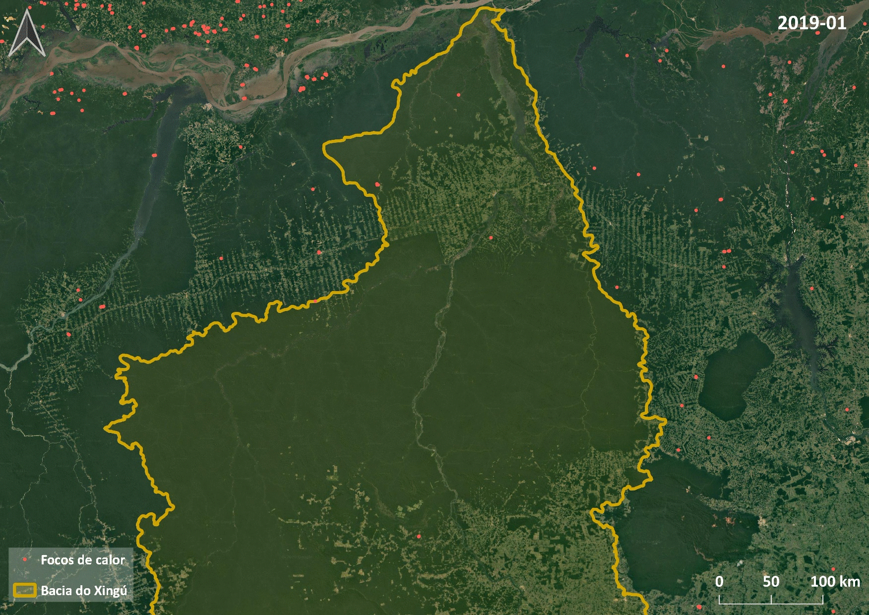
Given the importance and public interest on the subject, the Study and Research Unit, in partnership with the local teams and managers of the Indigenous Territorial Management Program, makes use, in its contracted products, of information released by the National Institute for Space Research (INPE) to monitor fires and the progress of deforested areas in sensitive regions of the national territory, as is the case of Indigenous Lands (TI).
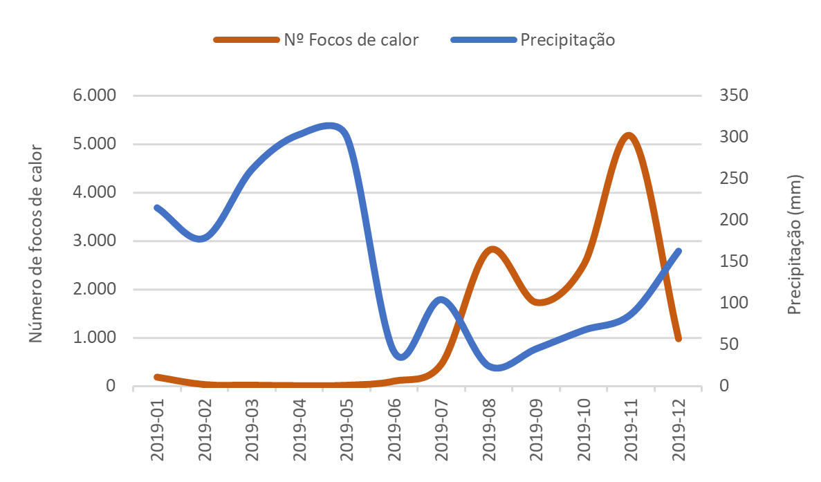
The study has been carried out since 2019 in three TIs located in the Xingu Basin. With the use of geoprocessing tools and geographic information that intersect the area of interest, the number of hotspots existing within the Indigenous Lands and in their Safety Range is monitored. In addition, the temporal and spatial variations of the foci are recorded. This information is related to historical levels of rainfall, deforested areas and some other indicators of environmental degradation sensitive to the region.
Figure 1. Monthly variation of hotspots and precipitation rates throughout the year
To monitor deforested areas, periodic reports are used on the use and occupation of the surroundings of protected areas with remote sensing techniques. This work is carried out using satellite images and geographic databases from the Real Time Deforestation Detection Program (DETER) and from the Brazilian Amazon Forest Monitoring Satellite Program (PRODES).
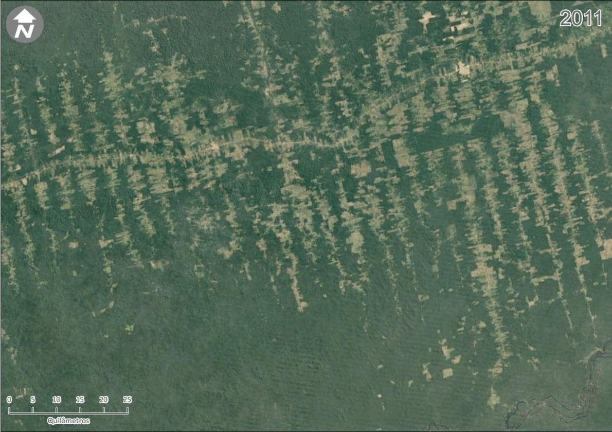
The figure below shows an example of deforestation monitoring through plant suppression in an area of the Xingu River basin, comparing satellite images from 2011 and 2019.
Figure 2. Plant suppression in an area of the Xingu River Basin, 2011 and 2019
In the last twelve months, more than 800 foci were mapped in the study area, approximately two-thirds in the Ethno-Environmental Security Range (FSEA)[1] and one-third of the foci within Indigenous Lands demarcated by FUNAI.
Regarding deforestation, there are several reports identified, through remote sensing and the use of secondary data, which so far already add up to an area of approximately 80 km².
This product offers numerous advantages to our customers, among them, the construction of an analytical base capable of guiding knowledge about the recent dynamics of the territory, offering clues, paths and strategies for the territorial management of protected areas. In addition, the use of geotechnology makes it possible to identify the vectors of threats to the integrity of territories, monitoring vulnerable areas and the possible causes of these occurrences.
Text prepared by:
Marcos Vinicius Quidas de Lima – Geoprocessing Coordinator
Vinicius Corrêa – Studies and Research Manager
[1]Ethnoenvironmental Security Range (FSEA) is defined from 10 km from the delimitation of the Indigenous Land.
*Article originally published on 10/20/20
Sign up and receive our news.